
Lake Windermere: Groyne marker installation
Learn about our project to install markers so that boaters will be aware of the low underwater structure that deflects river currents in Lake Windermere.
On this page
Project overview
- Location
-
Lake Windermere, British Columbia
- Type of project
-
Improvements
- Lead department
- Project status
-
Public feedback completed
- Next steps
-
Now that a new marker option has been chosen, we need to mark the structure, known as a groyne, to keep boaters safe. Long-term solutions will continue to be explored based on the feedback we received during the public consultation.
Project description
A groyne is an underwater structure that deflects river currents. The Lake Windermere groyne has deteriorated over the years, and in its current condition, poses a potential hazard to navigation. There is also a risk of environmental damage if a boat hits it. Navigational markers, including navigation signs and floating buoys, are used to alert boaters to underwater hazards. In order to protect the lake and those who use it, the groyne should be marked with navigational markers.
Options to mark the groyne in Lake Windermere
In 2022, we proposed 3 options for these markers.
-
Option 1: Tall marker piles
We would install 11 untreated wood piles. The wood piles would be driven into the bottom of the lake. When the water level is low, 5 metres of the marker would show above water. There would be a navigation sign on the pile at the eastern end of the groyne to tell boaters where the navigation channel is.
-
Option 2: Short marker piles
We would install 11 untreated wood piles, driven into the bottom of the lake. When the water level is low, 3 metres of the marker would show above water. There would be a navigation sign on the pile at the eastern end of the groyne to tell boaters where the navigation channel is.
-
Option 3: Marker buoys
Option 3: Marker buoys
We would install 11 buoys: 1 navigation buoy and 10 hazard buoys. Each buoy would be anchored in place. The buoys would be made of a strong plastic shell over rigid floatation foam. They would be made to be used in the water. The lines to the anchors would not float, so swimmers or boat propellers would not get tangled in them.
Result of engagement sessions
We engaged with local First Nations, government bodies and community members on the 3 proposed options. Based on the feedback we received, as well as other factors, we determined that option 3, the marker buoys, was the best option to mark the groyne.
Location
Lake Windermere is located near Invermere in southeastern British Columbia, within the Columbia River Valley. At 17.7 kilometres in length, it is one of the largest lakes in the region, and also has one of the warmest water temperatures.
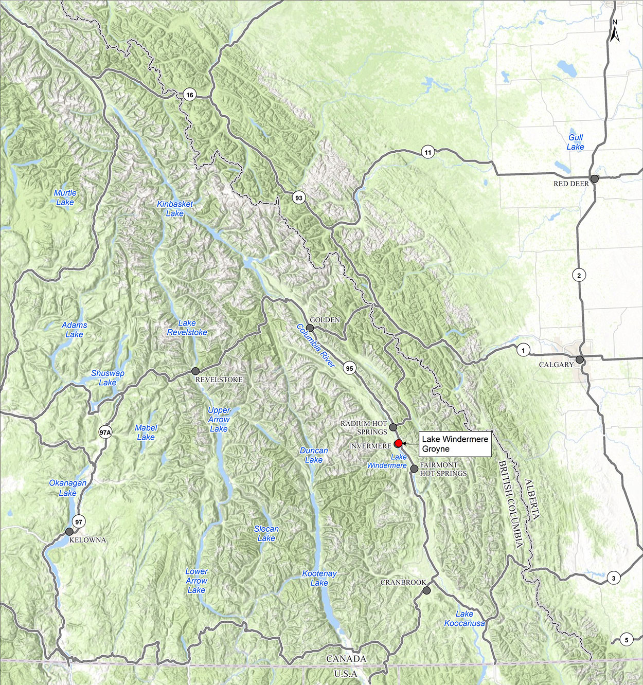
Lake Windermere, B.C.—Regional Map (prepared by Hemmera, 2021/06/17)
Sources:
- Contains information licensed under the Open Government Licences—Government of Canada, Province of British Columbia, Province of Alberta
- Basemap: ESRI World Topographic Map
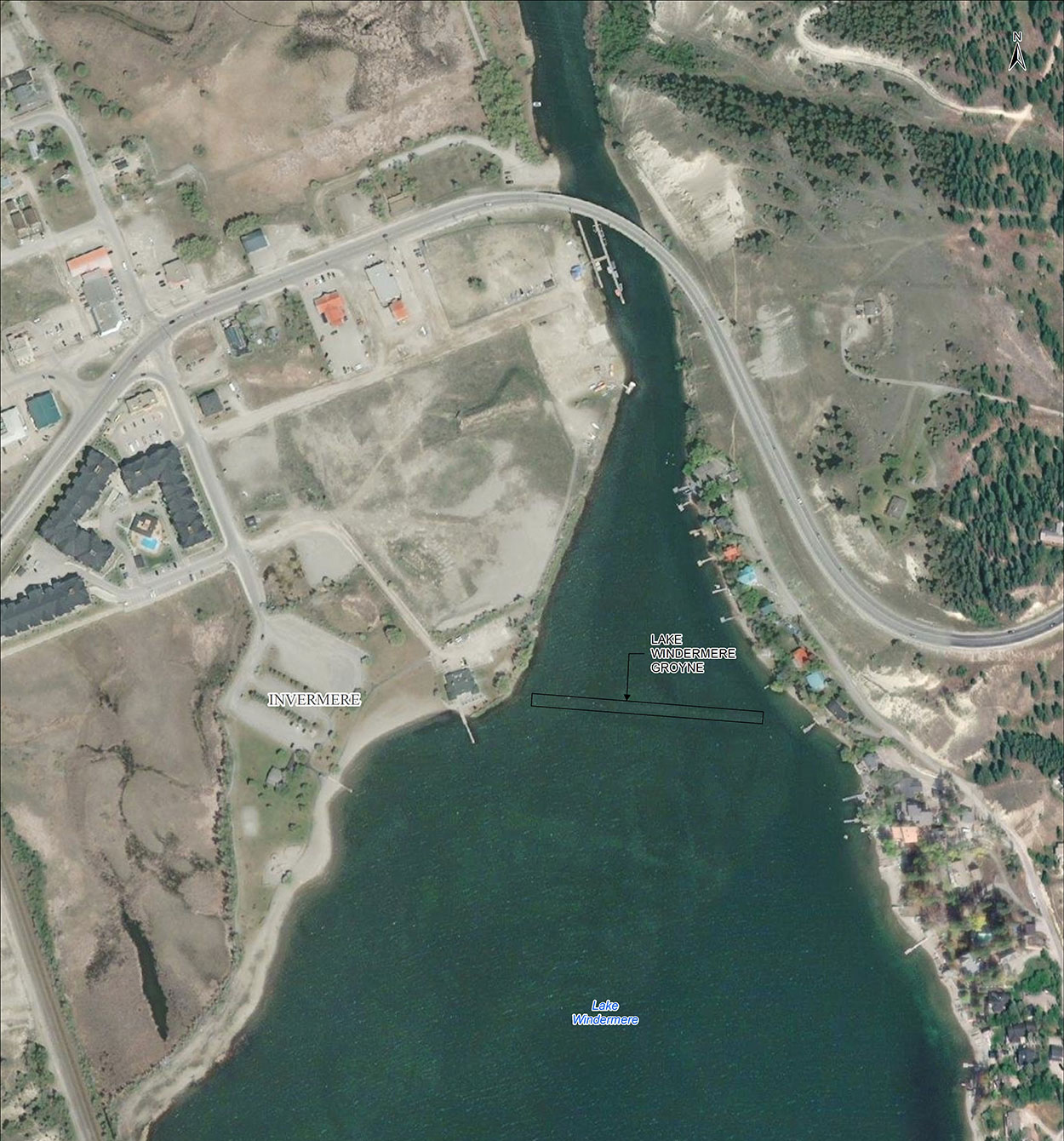
Aerial View of the Lake Windermere Groyne (prepared by Hemmera, 2021/06/17)
Sources:
- Aerial Image: ESRI World Imagery
Project background
Our records show that we built the groyne in Lake Windermere in the 1800s for steamships on the Columbia River. It has wood cribbing and rocks placed on top of a brush mattress.
Since we built the groyne, it is an asset under the department’s responsibility. As such, we are obligated to ensure that:
- it meets all regulatory requirements
- boaters using the immediate area of the groyne are safe
- changes in its condition do not cause environmental damage
Because the groyne extends from shallow water, near the west shoreline of the lake, to the shallow navigation channel on the east side, markers are required for its full length.
Contact us
For more information on the project, email the Lake Windermere Groyne Project team at tpsgc.rplacwindermere-prlakewindermere.pwgsc@pwgsc-tpsgc.gc.ca or write to us at:
Real Property Services
Real Estate Services
1230 Government St
Victoria, BC V8W 2Z4